Mount Kilimanjaro National Park

image-slider-with-thumbnail1.jpeg
image-slider-with-thumbnail2.jpeg
image-slider-with-thumbnail3.jpeg
image-slider-with-thumbnail4.jpeg
image-slider-with-thumbnail5.jpeg
PlayPause
image-slider-with-thumbnail1.jpeg
image-slider-with-thumbnail2.jpeg
image-slider-with-thumbnail3.jpeg
image-slider-with-thumbnail4.jpeg
image-slider-with-thumbnail5.jpeg
previous arrow
next arrow

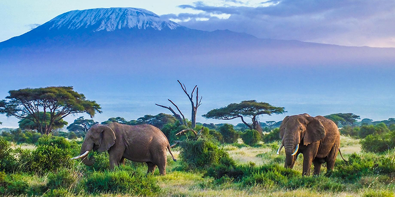
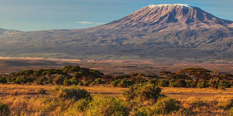
Kilimanjaro. The name itself is a mystery wreathed in clouds. It might mean Mountain of Light, Mountain of Greatness or Mountain of Caravans. Or it might not. The local people, the Wachagga, don’t even have a name for the whole massif, only Kipoo (now known as Kibo) for the familiar snowy peak that stands imperious, overseer of the continent, the summit of Africa.

Kilimanjaro, by any name, is a metaphor for the compelling beauty of East Africa. When you see it, you understand why. Not only is this the highest peak on the African continent; it is also the tallest free-standing mountain in the world, rising in breathtaking isolation from the surrounding coastal scrubland – elevation around 900 metres – to an imperious 5,895 metres (19,336 feet).

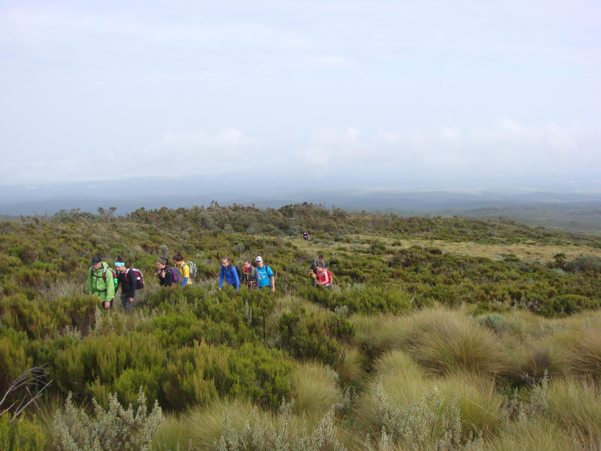
Kilimanjaro is one of the world’s most accessible high summits, a beacon for visitors from around the world. Most climbers reach the crater rim with little more than a walking stick, proper clothing and determination. And those who reach Uhuru Point, the actual summit, or Gillman’s Point on the lip of the crater, will have earned their climbing certificates and their memories.

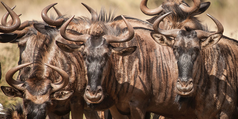
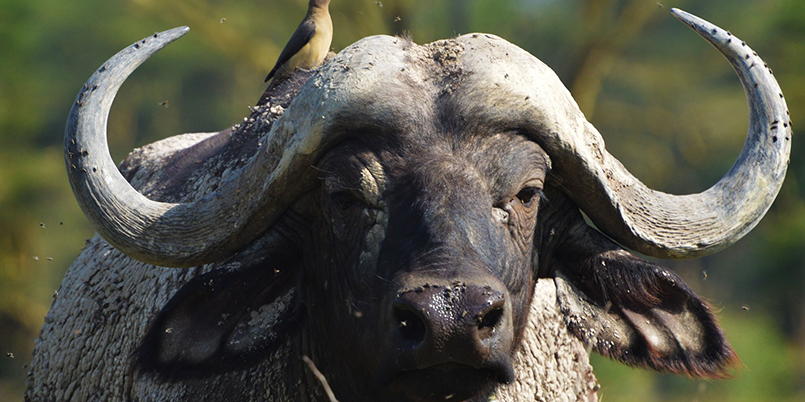
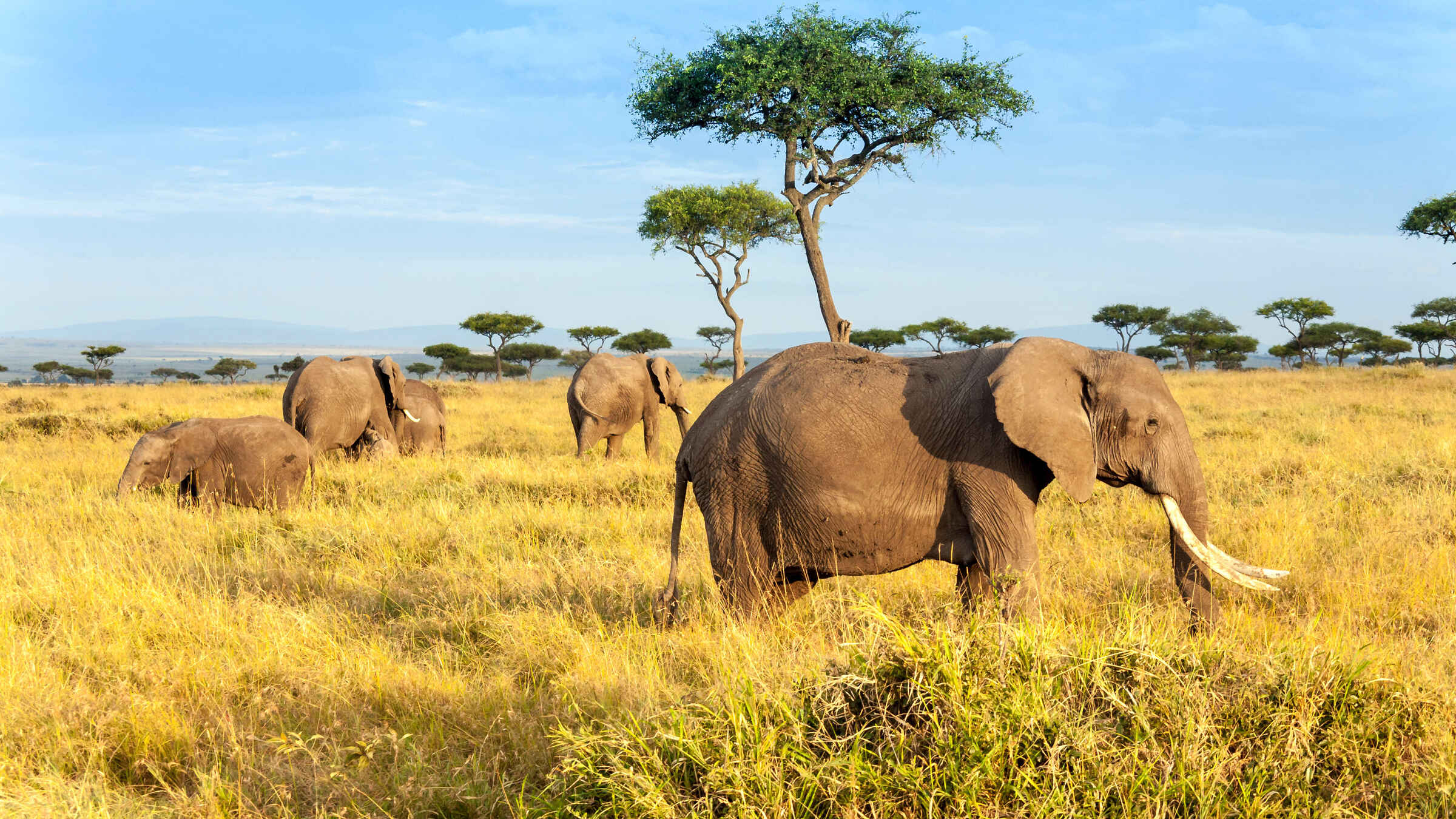
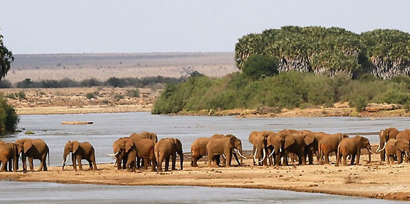
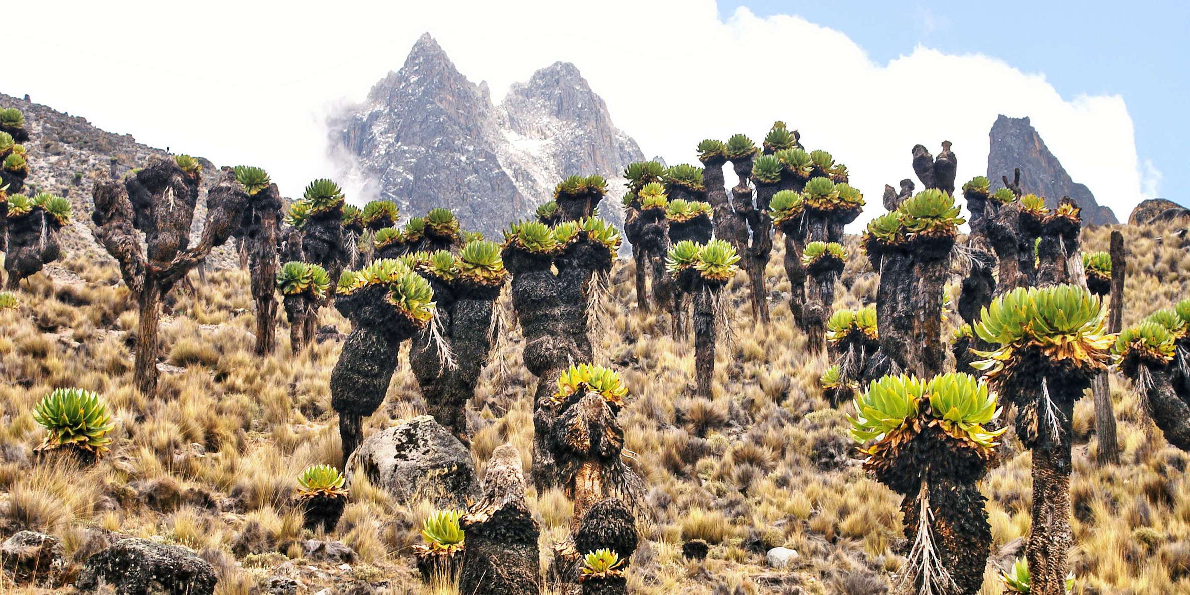
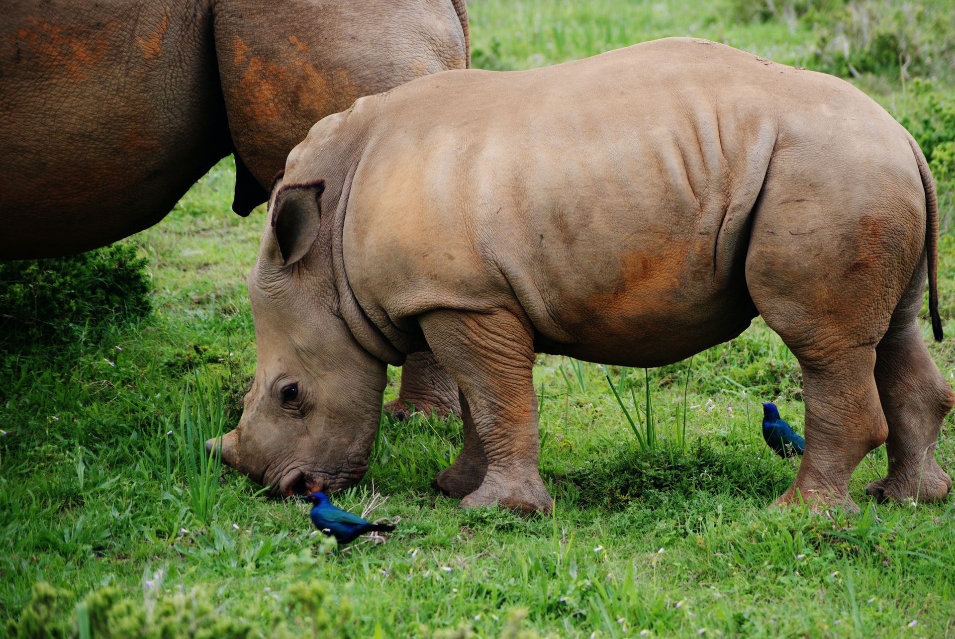
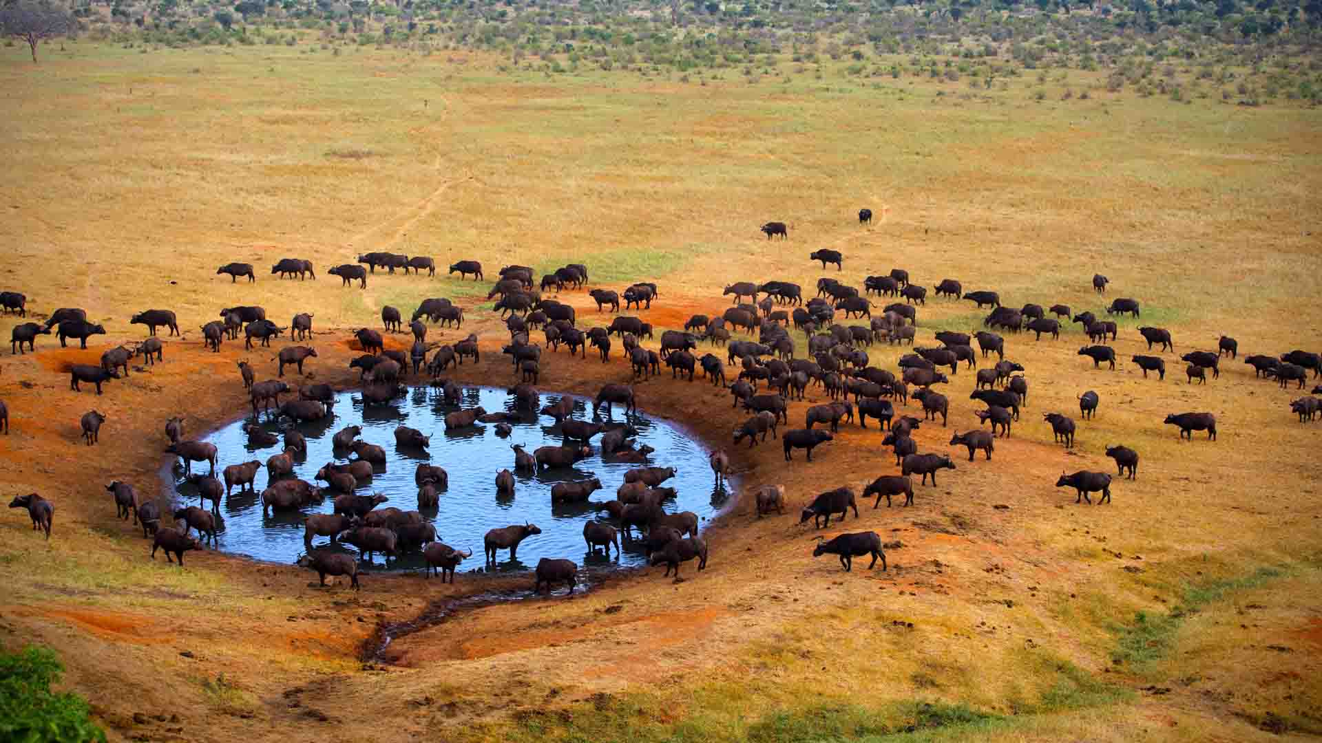
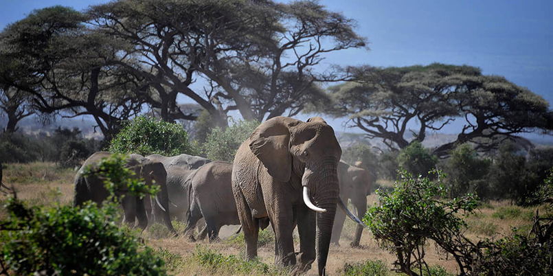
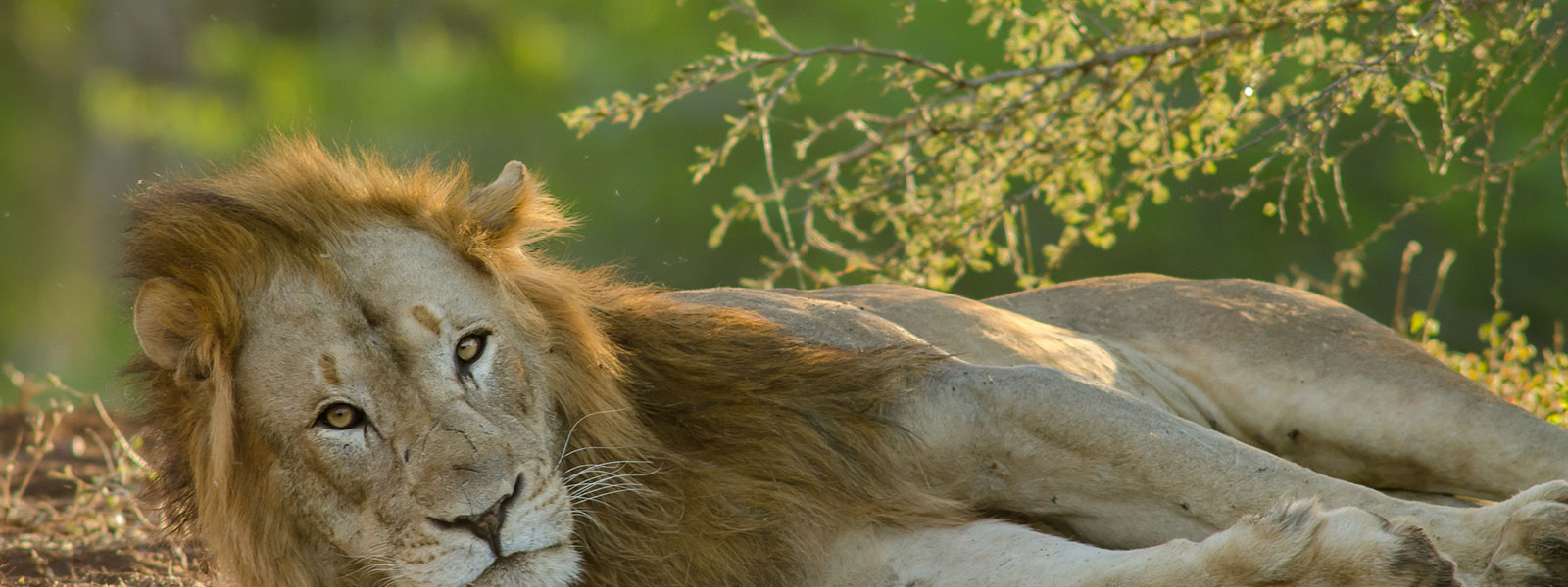
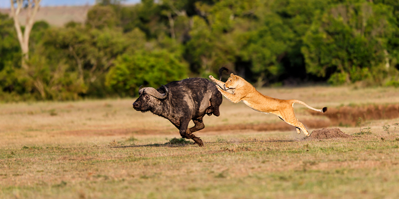
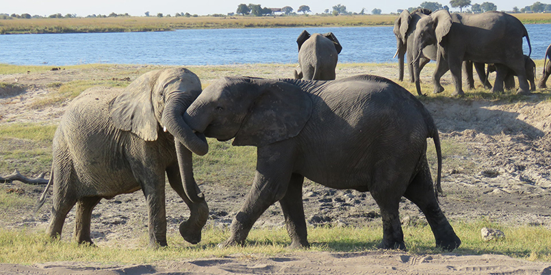
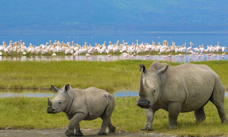
But there is so much more to Kili than her summit. The ascent of the slopes is a virtual climatic world tour, from the tropics to the Arctic. Even before you cross the national park boundary (at the 2,700m contour), the cultivated foots lopes give way to lush montane forest, inhabited by elusive elephant, leopard, buffalo, the endangered Abbot’s duiker, and other small antelope and primates. Higher still lies the moorland zone, where a cover of giant heather is studded with otherworldly giant lobelias.

Above 4,000m, a surreal alpine desert supports little life other than a few hardy mosses and lichen. Then, finally, the last vestigial vegetation gives way to a winter wonderland of ice and snow – and the magnificent beauty of the roof of the continent.

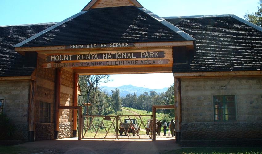
About Kilimanjaro National Park Size: 1668 sq km 641 sq miles). Location: Northern Tanzania, near the town of Moshi.

Getting there 128 km (80 miles) from Arusha. About one hour’s drive from Kilimanjaro airport.

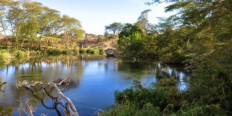
What to do Six usual trekking routes to the summit and other more-demanding mountaineering routes. Day or overnight hikes on the Shira plateau. Nature trails on the lower reaches. Trout fishing. Visit the beautiful Chala crater lake on the mountain’s southeastern slopes.

When to go Clearest and warmest conditions from December to February, but also dry (and colder) from July-September.

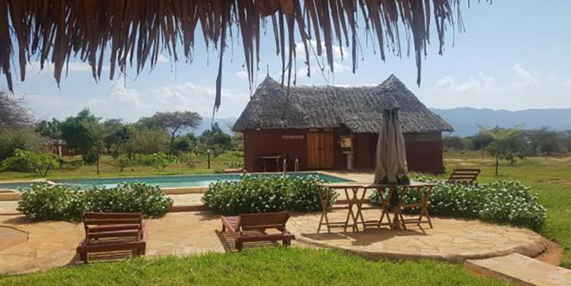
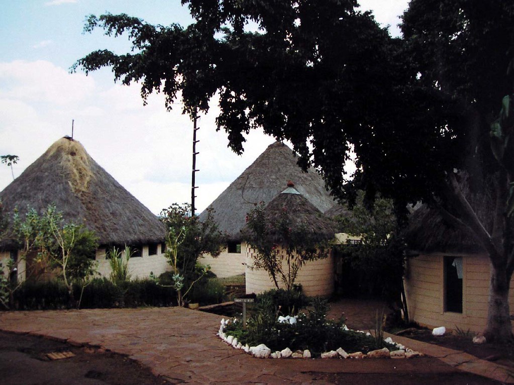
AccommodationHuts and campsites on the mountain. Several hotels and campsites outside the park in the village of Marangu and town of Moshi.

Masai Mara National Reserve

image-slider-with-thumbnail1.jpeg
image-slider-with-thumbnail2.jpeg
image-slider-with-thumbnail3.jpeg
image-slider-with-thumbnail4.jpeg
image-slider-with-thumbnail6.jpeg
PlayPause
image-slider-with-thumbnail1.jpeg
image-slider-with-thumbnail2.jpeg
image-slider-with-thumbnail3.jpeg
image-slider-with-thumbnail4.jpeg
image-slider-with-thumbnail6.jpeg
previous arrow
next arrow

The Masai Mara National Reserve is Kenya’s finest wildlife reserve. Everything about this reserve is outstanding. The wildlife is abundant and the gentle rolling grasslands ensure that animals are never out of sight. Birds, too, are prolific. Including migrants, well over 450 species have been recorded, among them, 57 species of birds of prey. The climate is gentle, rarely too hot and well-spread rainfall year round. Rain, when it falls almost always chooses the late afternoon or night. Between July and October, when the great wildebeest migration is in the Masai Mara National Reserve, the sensation is unparalleled. Masai Mara is one of the best plains’ game reserve where you can actually encounter a live Discovery Channel, a haven for viewing a congregation of all sorts of animals in a five-mile radius: A pride of lions can be spotted ready to make a run for a gazelle (actually, the last time we visited the Masai Mara we saw a lioness take down a giraffe), a cheetah and its cub taking a nap on a rock, a pair of ostriches walking the open stretches of the savannah or a gazelle giving birth (we saw this too).

The Masai Mara National Reserve lies about 270 kilometers from Nairobi, and takes about 4 to 5 hours by road. There are scheduled flights, twice daily from Wilson Airport Nairobi, which take about 40 – 45 minutes. The reserve is about 1510 square kilometers having been reduced from 1672 square kilometers in 1984. However, the wildlife is far from being confined within the reserve boundaries, and an even larger area, generally referred to as the “dispersal area” extends north and east of the Masai Mara National Reserve. Maasai communities live within the dispersal area with their stock but a century of close association with the wildlife has resulted in an almost symbiotic relationship where wildlife and people live in peace with one another. The first sight of this natural wonderland is breathtaking. Here the great herds of shuffling elephants browse among the rich tree-studded grasslands with an occasional sighting of a solitary and ill-tempered rhino.

Thomson’s and Grant’s gazelle, Topi and Eland and many more species of plains’ game offer a rich choice of food for the dominant predators; lion, leopard and cheetah which hunt in this pristine wilderness. In the Mara River, hippo submerges at the approach of a vehicle only to surface seconds later to snort and grumble their displeasure. Seemingly, the drowsy crocodile sunbathe on the riverbanks, mouth agape, waiting with subtle cunning for prey at which to strike with lightning swiftness. But this richness of fauna, this profusion of winged beauty and the untouched fragility of the landscape, are all subordinate to the Mara’s foremost attraction, the march of the wildebeest. 

Each year, far south in the great vastness of the Serengeti, the wildebeest raise their dignified but quaint heads, sniff the air and, as if by one accord, start the long trek to the Kenya border and the Masai Mara National Reserve. After exhausting the grazing in Tanzania’s northern Serengeti, a large number of wildebeest and zebra enter the Masai Mara National Reserve around the end of June drawn by the sweet grass raised by the long rains of April and May. It is estimated that more than half a million wildebeest enter the Masai Mara National Reserve and are joined by another 100,000 from the Loita Hills east of the Masai Mara. Driving in the midst of these great herds is an unimaginable experience. Whilst the eyes feast on the spectacle, the air carries the smells, the dust and the sounds of hundreds of thousands of animals. There is nowhere else on earth to compare with this wildlife marvel. But the trek is costly. The herds’ draw ravening packs of predators, especially hyenas and lions, and thousands of the lame, laggard and sick never complete the cycle. More die, by drowning or by the teeth of the cunning crocodile, while trying to cross the swirling muddy waters of the Mara and Talek rivers. Once the Masai Mara National Reserve’s grass has been devoured and when fresh rain in Tanzania has brought forth a new flush there, the herds turn south, heading hundreds of kilometers back to Serengeti and the Ngorongoro plains. There the young are dropped in time to grow sufficiently strong to undertake the long march north six months later. 


Although July, August and September are the months when the Masai Mara plains are filled with migrating wildebeest and zebra, there is much resident wildlife year round. Apart from the better-known species there are numerous opportunities to add some of the rare and less frequently seen animals to the visitor’s checklist. In the southwestern sector, you may be lucky enough to see roan antelope, a handsome creature regrettably rare countrywide. Bat-eared foxes peer from their burrows and there are thousands of topi, an antelope not found in other major parks save Tsavo National Park. The combination of a gentle climate, scenic splendor and untold numbers of wildlife makes the Masai Mara Kenya’s most popular inland destination park.

Tsavo West National Park- “The Land of Lava man-eaters, Springs and so much more..”

image-slider-with-thumbnail1.jpeg
image-slider-with-thumbnail2.jpeg
image-slider-with-thumbnail3.jpeg
image-slider-with-thumbnail4.jpeg
image-slider-with-thumbnail5.jpeg
PlayPause
image-slider-with-thumbnail1.jpeg
image-slider-with-thumbnail2.jpeg
image-slider-with-thumbnail3.jpeg
image-slider-with-thumbnail4.jpeg
image-slider-with-thumbnail5.jpeg
previous arrow
next arrow

Tsavo West National Park covers 7065 km2, approximately 30% of Kenya’s area under parks, and contains a diversity of habitats, wildlife and a mountainous scenic landscape.

The park is a vast expanse of savanna stretching from Mtito Andei, along the Mombasa-Nairobi road and south to the Tanzanian border. The North Eastern boundary along the Highway adjoins Tsavo East National Park, but Tsavo West has a more varied topography and a more diverse array of habitats than its neighbour.

The park’s habitats include open plains alternating with Savannah bush and semi desert scrub, acacia woodlands; rocky ridges and outcrops and more extensive ranges and isolated hills; belts of riverine vegetation; palm thickets and on the Chyulu hills, mountain forest.

There are numerous rocky outcrops and ridges and part of the park, towards the Chyulu Hills, is of recent volcanic origin with lava flows and ash cones including the Shetani lava flow, an example of a recent volacano.

In the far south western corner on the Kenya Tanzania border is Lake Jipe, part of which is in the park. This very attractive lake is fed by runoff from Mt. Kilimanjaro and the North Pare mountains.

At Mzima Springs, in the North of the park, water that has filtered underground from the Chyulu Hills gushes from below a lava ridge into a series of clear pools.

Location:

South Eastern Kenya, inland from Mombasa, and the altitude ranges between 200 – 1000m.

Climate:

Temperature ranges from 20 – 30o C and rainfall from 200mm – 700mm. Two ran seasons: Long rains – March/April & Short rains – Nov/December.

Major Attractions:

Recent volcanoes, lava flows and caves with potential for geological and cave exploration, and hiking. Mzima Springs & underwater hippo watching, Ngulia Rhino Sanctuary, Lake Jipe, Mt. Kilimanjaro, elephant, rhino, diverse bird and plant species. And if lucky – Wild dogs.

Facilitites:

Lodges: Ngulia Lodge; Kilaguni Serena Lodge; Severin Safari Camp/Lodge; Finch Hattons.

Campsites: Lake Jipe (public); Kamboya (public); Royal Little (special); Simba (special); Kenge (special); Kudu (special). Others: Kamboyo guesthouse; Tsavo West Information Visitor Centre.

Bandas: Lake Jipe; Kitani; Ngulia.

Picnic Sites: Poachers look out; Chaimu Crater; Shetani Lava Flow; Roaring Rocks; Mzima Springs; Visitor Information Centre Picnic Site.

Common Vegatation:

Most of the northern sector is Acacia commiphora bushland with scattered trees such as baobabs – Adansonia digitata and Delonix elata. In the Ngulia area, a range of craggy hills reaches around 1800m and is heavily wooded. The southern sector consists of open grassy plains. The permanent tsavo river runs through the northern part of the park with a fringe of riverine Acacia elatior and Hyphaene compressa woodland. Lake Jipe is bordered by extensive beds to Typha and has large permanent swamps at its eastern and western ends. Mzima springs, is fringed by Raphia farinifera and Phoenix reclinata palms.

Visitor Activities Boat excursion at lake Jipe; Bird watching at lake Jipe; Annual bird ringing at Ngulia lodge; Hill and rock climbing at Chaimu and Ngulia Hills.

Mount Kenya National Park

image-slider-with-thumbnail1.jpeg
image-slider-with-thumbnail2.jpeg
image-slider-with-thumbnail3.jpeg
image-slider-with-thumbnail4.jpeg
image-slider-with-thumbnail5.jpeg
image-slider-with-thumbnail6.jpeg
image-slider-with-thumbnail7.jpeg
PlayPause
image-slider-with-thumbnail1.jpeg
image-slider-with-thumbnail2.jpeg
image-slider-with-thumbnail3.jpeg
image-slider-with-thumbnail4.jpeg
image-slider-with-thumbnail5.jpeg
image-slider-with-thumbnail6.jpeg
image-slider-with-thumbnail7.jpeg
previous arrow
next arrow

Mt. Kenya is an imposing extinct volcano dominating the landscape of the Kenyan Highlands, East of the Rift Valley. Mt. Kenya lies about 140 km North, North-East of Nairobi with its Northern flanks across the Equator. The mountain has two main peaks – Batian (5200m) and Nelion (5188m). The mountains slopes are cloaked in forest, bamboo, scrub and moorland giving way on the high central peaks to rock, ice and snow. Mt. Kenya is an important water catchment area, supplying the Tana and Northern Ewaso Ngiro systems.

The park includes a variety of habitats ranging from higher forest, bamboo, alpine moorlands, glaciers, tarns and glacial morains.

The park, which was inscribed by UNESCO as a World Heritage Site in 1997 and is also a Biosphere Reserve, covers 715 km2, and includes the Peaks consisting of all the ground above 3200m with two small salients extending lower down to 2450m along the Sirimon and Naro Moru tracks. Surrounding the park is Mount Kenya National Reserve with an area of approximately 2095 km2.

Climate:

Climate, flora and fauna on Mt. Kenya varies with altitude.

MAJOR ATTRACTIONS

Pristine wilderness, lakes, tarns, glaciers and peaks of great beauty, geological variety, forest, mineral springs, rare and endangered species of animals, High altitude adapted plains game, Unique montane and alpine vegetation with 11 species of endemic plants.

Facilities:

Huts: Liki North Hut; Minto’s Hut; Austrian Hut; Mackinders Hut (managed by Naro Moru Lodge); Judmare Hut; Shiptons Hut (managed by Mountain Rock Hotel).

Bandas.

Lodges: Mountain Lodge; Rutundu Fishes Lodge Activities:

Mountain climbing, game viewing.

Common Vegetaion: This varies with altitude and rainfall, and there is a rich alpine and sub-alpine flora.

Between 1200m and 1850m, the vegetation is mainly dry upland forest comprising of Croton associations. Juniperus procera and Podocarpus spp. are predominant in the drier parts of the lower zone (below 2,500m), with rainfall between 875 and 1400mm (Naro Moru and Sirimon tracks on the western slopes). In wetter areas (over 2200mm/year) in the south-west and north-east, Cassipourea malosana predominates.

Higher altitudes (2,500-3,000m with rainfall over 2000mm/year) are dominated by a dense belt of bamboo Arundinaria alpina on south-eastern slopes, and a mosaic of bamboo and Podocarpus milanjianus with bamboo at intermediate elevations (2,600-2,800m), and Podocarpus at higher and lower elevations (2,800-3,000m) and (2,500-2,600m).

Towards the west and north of the mountain, bamboo becomes progressively smaller and less dominant. There are also areas in zones of maximum rainfall 2,000-3,500m with up to 2,400mm/year, where Hagenia abyssinica with Hagenia revolutum predominate.

Above 3,000m, cold (low temperatures) become a more important factor, tree stature declines, and Podocarpus is replaced by Hypericum spp. A more open canopy here results in a more developed understorey. Many of the trees are festooned with mosses. Grassy glades are common especially on ridges. High altitude heath between 3,000m and 3,500m is characterised by shrubs with small leaves like African sage, Protea and Helicrysum.

The lower alpine or moorland zone (3,400-3,800m) is characterized by high rainfall, a thick humus layer, low topographic diversity, and low species richness. Tussock grasses Festuca pilgeri, and sedges Carex spp. predominate. Between the tussocks there are Alchemilla cyclophylla, Alchemilla johnstonii, and Geranium vagans. Above the 3500m contour is the Afro-alpine zone, a moorland characterised by tussock grasses, senecios and lobelias.

The upper alpinezone (3,800-4,500m) is more topographically diverse, and contains a more varied flora. Many of the species here are bizarre, especially the giant rosette plants Lobelia telekii and Lobelia keniensis, Senecio keniodendron and Carduus spp.. Senecio brassica is found in both the lower and upper alpine zone.

There are a variety of grasses on well-drained ground and along the streams and river banks such as megaphytic Senecio battescombei and Helichrysum kilimanjari.

Continuous vegetation stops at about 4,500m although isolated vascular plants have been found at over 5,000m. There are 13 species endemic to Mount Kenya listed in Hedberg, (1951).

Meru National Park – “Complete Wilderness”

image-slider-with-thumbnail1.jpeg
image-slider-with-thumbnail2.jpeg
image-slider-with-thumbnail3.jpeg
image-slider-with-thumbnail4.jpeg
image-slider-with-thumbnail5.jpeg
image-slider-with-thumbnail6.jpeg
image-slider-with-thumbnail7.jpeg
PlayPause
image-slider-with-thumbnail1.jpeg
image-slider-with-thumbnail2.jpeg
image-slider-with-thumbnail3.jpeg
image-slider-with-thumbnail4.jpeg
image-slider-with-thumbnail5.jpeg
image-slider-with-thumbnail6.jpeg
image-slider-with-thumbnail7.jpeg
previous arrow
next arrow

Meru is a savanna National Park, 35km east of Maua town in the north eastern lowlands below the Nyambeni hills. Meru is part of a complex of protected areas along the Tana river that includes the adjacent Bisanadi and Mwingi National Reserves (to the east and south respectively), Kora national park and Rahole national reserve. The wetter North Western sector is hilly, with rich volcanic soils. The land flattens towards the East, where grey alluvial volcanic soils appear.

The area is crossed by numerous permanent streams, draining from the Nyambenes and flowing in parallel between tounges of lava, south eastwards towards the Tana River. As well as the many streams that cross it, the park is bounded by three large rivers: the Tana to the South, the Ura to the South West and the Rojeweru to the East. There are several prominent inselbergs of basement rock, notably Mughwango and Leopard rock.

A section of the park has been designated as a wilderness area in which are no roads. The park is part of the domain made famous by the writings of Joy Adamson.

Location:

East-north-east of Mount Kenya in Meru District of Eastern Province, coverig 870km2.

Climate:

Rainfall is 635-762mm in the west and 305-356mm in the east.

Major Attractions:

Former home of Joy and George Adamson and Elsa the lioness,

Views of Mt Kenya,

Rivers and riverine habitats,

Tana river and

Adamson’s Falls.

Facilities:

Special Campsites:- (no facilities, prior booking with Kshs. 5000 needed).
Kampi Baridi; Kitanga; Makutano; Rojoweru; Mugunga; Ken Mare and Kanjoo.

Public campsite:- (with toilets and showers).
Bwatherongi.

Activities:

Game viewing.

Common Vegetation: 

Most of the park is covered by bush, thornbush and wooded grassland of varying densities with Combretum prevailing in the north and Commiphora in the south. In the extreme north there is a small remnant outliner of rain forest, the Ngaia forest.

The vegetation on the ridges is Combretum wooded grassland, dominated by Combretum apiculatum. This grades into acacia wooded grassland to the east with Acacia tortilis and Acacia senegal on the rocky ridges, in riverine thickets and dotted over open country. To the west the Combretum merges into Terminalia wooded grasslands.

On the plains Sehima nervosa, Chloris gayana, Chloris roxburghiana, and other species of Pennisetum are the dominant grasses.

Dense riverine forests of doum and raffia palms Hyphaene and Raphia spp. grow along the watercourses and in the swamps near the rivers. Along the Tana river is found the Tana river poplar, Populus ilicifolia. Other riverine trees include Phoenix reclinata, Ficus sycomorus, Newtonia hildebrandtii, Acacia elatior and Acacia robusta. The red-flowered Parasitic Loranthus grows on the branches of Acacia reficiens trees along the rivers.

There are numerous riverine swamps with sedges Cyprus sp. and grasses Echinochloa haplacelada and Pennisetum mezianum.

Nakuru National Park- ” Bird Watchers’ Paradise”

image-slider-with-thumbnail1.jpeg
image-slider-with-thumbnail2.jpeg
image-slider-with-thumbnail3.jpeg
image-slider-with-thumbnail4.jpeg
PlayPause
image-slider-with-thumbnail1.jpeg
image-slider-with-thumbnail2.jpeg
image-slider-with-thumbnail3.jpeg
image-slider-with-thumbnail4.jpeg
previous arrow
next arrow

Lake Nakuru is a very shallow strongly alkaline lake 62 km2 in extent. It is set in a picturesque landscape of surrounding woodland and grassland next to Nakuru town. The landscape includes areas of marsh and grasslands alternating with rocky cliffs and outcrops, stretches of acacia woodland and rocky hillsides covered with a Euphorbia forest on the eastern perimeter.

The lake catchment is bounded by Menengai crater to the north, the Bahati hills to the north east, the lion hill ranges to the east, eburu crater to the south and the mau escarpment to the west. Three major rivers, the njoro, makalia and enderit drain into the lake, together with treated water from the town’s sewage works and the outflow from several springs along the shore.

Lake Nakuru was first gazetted as a bird sanctuary in 1960 and upgraded to National Park status in 1968. A northern extension was added to the park in 1974 and the lake was designated as a Ramsar site in 1990. The foundation of the parks food chains is the cyanophyte spirulina platensis which can support huge numbers of lesser flamingo.

Location:

Central Kenya, 140km north-west of Nairobi, in Nakuru District of the Rift Valley Province. It covers an area of 188 km2.

Climate:

Ranges from Cold, Hot and Humid, Hot and Dry. Annual rainfall is 965mm.

  • MAJOR ATTRACTIONS
  • Flamingo (Greater and Lesser) and other water birds including a variety of terrestrial birds numbering about 450 species in total.
  • Mammals: 56 different species including white rhinos.
  • View-points: Lion hill, Baboon cliff and Out of Africa
  • Hills: Enasoit, Honeymoon, Lion hill ridge etc.
  • Waterfalls: Makalia
  • Unique vegetation: About 550 different plant species including the unique and biggest euphorbia forest in Africa, Picturesque landscape and yellow acacia woodlands.

FACILITIES

  • Bandas 
  • Lodges: Lake Nakuru lodge & Sarova Lion Hill Lodge.
  • Special Campsites: Naishi, Chui, Rhino, Soysambu, Nyati, Nyuki and reedbuck.
  • Public Campsites: Makalia and Backpackers.

ACTIVITIES

Game viewing, bird watching.

COMMON VEGETATION

The vegetation is mainly wooded and bushy grassland with a wide ecological diversity and characteristic habitats that range from the lake waters to the escarpment and ridges.

The normally water-covered surface of the lake occupies about a third of the park. The lake water supports a dense bloom of the blue-green Cyanophyte Spirulina platensis from which it derives its colour and which is the major food source for the flamingo.

The lake is fringed by alkaline swamps with areas of sedge, Cyprus laevigatus and typha marsh along the river inflows and springs. The surrounding areas support a dry transitional savanna with lake margin grasslands of Sporobolus spicatus salt grass moving into grasslands of Hyparrhenia hirta and rhodes grass Chloris gayana in the lower areas.

More elevated areas have dry forest with Acacia xanthophloea, olive Olea hochstetteri and Croton dichogamus; Euphorbia candelabrum forest; and bushland dominated by the composites, Mulelechwa Tarchonanthus camphoratus and Psiadia arabica.

Rocky hillsides on the Parks eastern perimeter are covered with Tarchonanthys scrub and a magnificent Euphobia candelabrum forest.

Hells Gate

image-slider-with-thumbnail1.jpeg
image-slider-with-thumbnail2.jpeg
image-slider-with-thumbnail3.jpeg
image-slider-with-thumbnail4.jpeg
PlayPause
image-slider-with-thumbnail1.jpeg
image-slider-with-thumbnail2.jpeg
image-slider-with-thumbnail3.jpeg
image-slider-with-thumbnail4.jpeg
previous arrow
next arrow

Hell’s Gate National Park covers an area of 68.25 km2 and is situated in the environs of Lake Naivasha about 90 km from Nairobi. The park is situated 14 km after the turnoff from the old Nairobi-Naivasha highway. It is characterised by diverse topography and geological scenery. It is an important home of the lammergeyer.

Location:

Hell’s Gate or Njorowa Gorge is situated in Nakuru District, Rift Valley Province, covering an Area of 68 km2.

Climate:

Warm and dry.

Major Attractions

Game viewing, Raptor nesting in cliffs, Spectacular gorge walk, hot springs, scenic landscape, the Geothermal Station, Maasai culture.

Facilities:

Bandas:

Narasha Guesthouse

Campsites:

Oldubai Campsite, Naiburuta, Endacha.

Picnic Sites:

Trails: Gorge, Fisher’s Tower, Obsidian Cave.

Activities: Hiking, camping, rock climbing, biking, bird watching and wildlife viewing.

Amboseli National Park

image-slider-with-thumbnail1.jpeg
image-slider-with-thumbnail2.jpeg
image-slider-with-thumbnail3.jpeg
image-slider-with-thumbnail4.jpeg
image-slider-with-thumbnail5.jpeg
PlayPause
image-slider-with-thumbnail1.jpeg
image-slider-with-thumbnail2.jpeg
image-slider-with-thumbnail3.jpeg
image-slider-with-thumbnail4.jpeg
image-slider-with-thumbnail5.jpeg
previous arrow
next arrow

 Amboseli lies immediately North West of Mt. Kilimanjaro, on the border with Tanzania. Amboseli was established as a reserve in 1968 and gazette as a National Park in 1974. The Park covers 392 km2, and forms part of the much larger 3,000 Km2 Amboseli ecosystem. Large concentrations of wildlife occur here in the dry season, making Amboseli a popular tourist destination. It is surrounded by 6 communally owned group ranches.

The National Park embodies 5 main wildlife habitats (open plains, acacia woodland, rocky thorn bush country, swamps and marshland) and covers part of a pleistocene lake basin, now dry. Within this basin is a temporary lake, Lake Amboseli, that floods during years of heavy rainfall. Amboseli is famous for its big game and its great scenic beauty – the landscape is dominated by Mt. Kilimanjaro.

Location: On the border with Tanzania, Kajiado District, South Kenya; Covers 392km2.

Climate: The climate is mainly hot and dry. Amboseli is in the rain shadow of Mt. Kilimanjaro. The maximum average temperature of the warmest month is 33°C during the day, while that of the coldest is 27-28°C. An annual rainfall of 300mm per annum is distributed in two seasons: April/May and November/December. Recurrent droughts and potential evaporation of 2200mm per annum typifies the region (KWS, 1991).

Major Attractions:

  • Mt. Kilimanjaro
  • Mt. Meru
  • Observation Hill which allows an overall view of the whole park especially the swamps and elephants,
  • Contemporary Maasai culture and indigenous lifestyle.

Facilities:

  • Lodges: Oltukai Lodge; Amboseli Serena Lodge; Kimana Lodge; Tortilis Tented Lodge.
  • Campsites: Nairushari Special; Olgulului Public Campsite; Abercrombie & Kent Tented Camp; Ker & Downy Tented Camp; Chyulu Tented Camp; Kimbla Campsite; Cottar’s Tented Camp; Leopard Tented Camp; Tortilis Tented Camp.

Activities:

  • Wildlife viewing.

Tailor-made Safaris

image-slider-with-thumbnail1.jpeg
image-slider-with-thumbnail2.jpeg
image-slider-with-thumbnail3.jpeg
PlayPause
image-slider-with-thumbnail1.jpeg
image-slider-with-thumbnail2.jpeg
image-slider-with-thumbnail3.jpeg
previous arrow
next arrow

Adventure Holiday is a tour operator specializing in creating exciting adventure safaris for people like you that are looking for something different.

We also offer tailor made itineraries to the destination of you choice including conventional game watching safaris to all national parks and Game reserves in Kenya, Tanzania and Botswana. You can contact us with an outline itinerary or just mention your preferred destination and we will come up with a detailed itinerary and cost for you.

Clown of the Plains Safari

image-slider-with-thumbnail1.jpeg
image-slider-with-thumbnail2.jpeg
image-slider-with-thumbnail3.jpeg
PlayPause
image-slider-with-thumbnail1.jpeg
image-slider-with-thumbnail2.jpeg
image-slider-with-thumbnail3.jpeg
previous arrow
next arrow

Day:

01-02

Leave Nairobi and drive southeastwards to Amboseli National Park. With its backdrop of the snow-capped Mount Kilimanjaro (Africa’s highest mountain) and the abundant wildlife, Amboseli is a real spectacle. This is where you are most likely to see large herds of elephants and plains game. On day 2 we spend the whole day driving through different locations in the Amboseli National park and watching animals as they feed or groom each other. Return back to the camp for dinner and overnight.

Day:

03-04

Leave Amboseli after breakfast and drive via Nairobi to the Hells Gate National Park and set a camp on top of the cliff on arrival. We will take an afternoon game walk then back to the Camp for dinner and overnight. The Following morning we take game walk in Hells Gate National park where we have close encounters with zebra, giraffe, and a spectrum of other animals and birds. There are also fascinating sights of volcanic formations, geysers and hot springs. We will then visit Lake Naivasha in the afternoon where we take a boat ride for a close-up view of the hippos and a variety of bird species.

Day:

05

Depart after breakfast and drive along the edge of the escarpment from where we enjoy good views of the Great Rift Valley with its volcanic mountains and softly rolling hills. We’re headed for Loita plains to Olonganaiyo where we pitch our camp on arrival. The game walk takes us through less trodden, delicate and fragile scenic environments. In addition to encountering wild animals in their natural habitats, there is opportunities of real fun that involves hiking closer to them on foot besides meeting the local maasai people as they go about their day today activities. Visiting of the maasai village will be worthwhile as it offers the true culture unlike those often seen in the main tourist circuits. While walking we are likely to see zebra, giraffe, and various types of gazelle and antelope as well as finding fragments of stone tools used by early humans.

Day:

06

Depart after breakfast and drive headed for Masai Mara, one of the greatest wildlife spectacles in East Africa. We arrive at Mara Springs Safari Camp in the early afternoon to a welcome hot shower and lunch. in the afternoon we take a late afternoon game drive then back to the camp for dinner and overnight in a camp. The following day we spend the whole day driving through different locations in the mara game reserve and watching animals as they feed or groom each other. A short break from the mid day heat sees us seated beside the Hippo Pool having our picnic lunch as we watch hippos gracefully swim or bask lazily. By the time we return to the camp in the evening, we’ve hopefully seen the most of the big five and a lot of other species including birds. Dinner and overnight at the camp.

Day:

07

Before returning back to Nairobi, you take an early morning game drive then return back to the camp for breakfast. We relax around the camp before an early lunch after which we back to Nairobi arriving in the late afternoon. You will be droped off at your reserved Hotels and for those taking their flight back home will be dropped of at the airport.